top of page


Accurate Data & Measurements
3D models, site maps, and volumetric
calculations to keep your
project precise.
Cost Savings
Catch issues early, reduce rework, and
minimize labor-intensive inspections.
Improved Safety
Inspect hazardous areas remotely and
monitor site safety compliance.
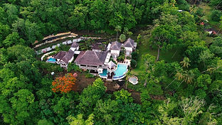
Marketing & Client Relations
Stunning visuals & media for investors, stakeholders future buyers or events.
Regulatory & Environmental
Compliance
Document progress, track impact and stay audit-ready
Why Choose Us?


For more than a decade...
We have advanced our expertise in drone technology to deliver precise and reliable aerial solutions.
Our capabilities extend beyond photography, offering a comprehensive range of services including aerial cinematography, site mapping and inspection across multiple industries.
bottom of page